The Climate of
Finland
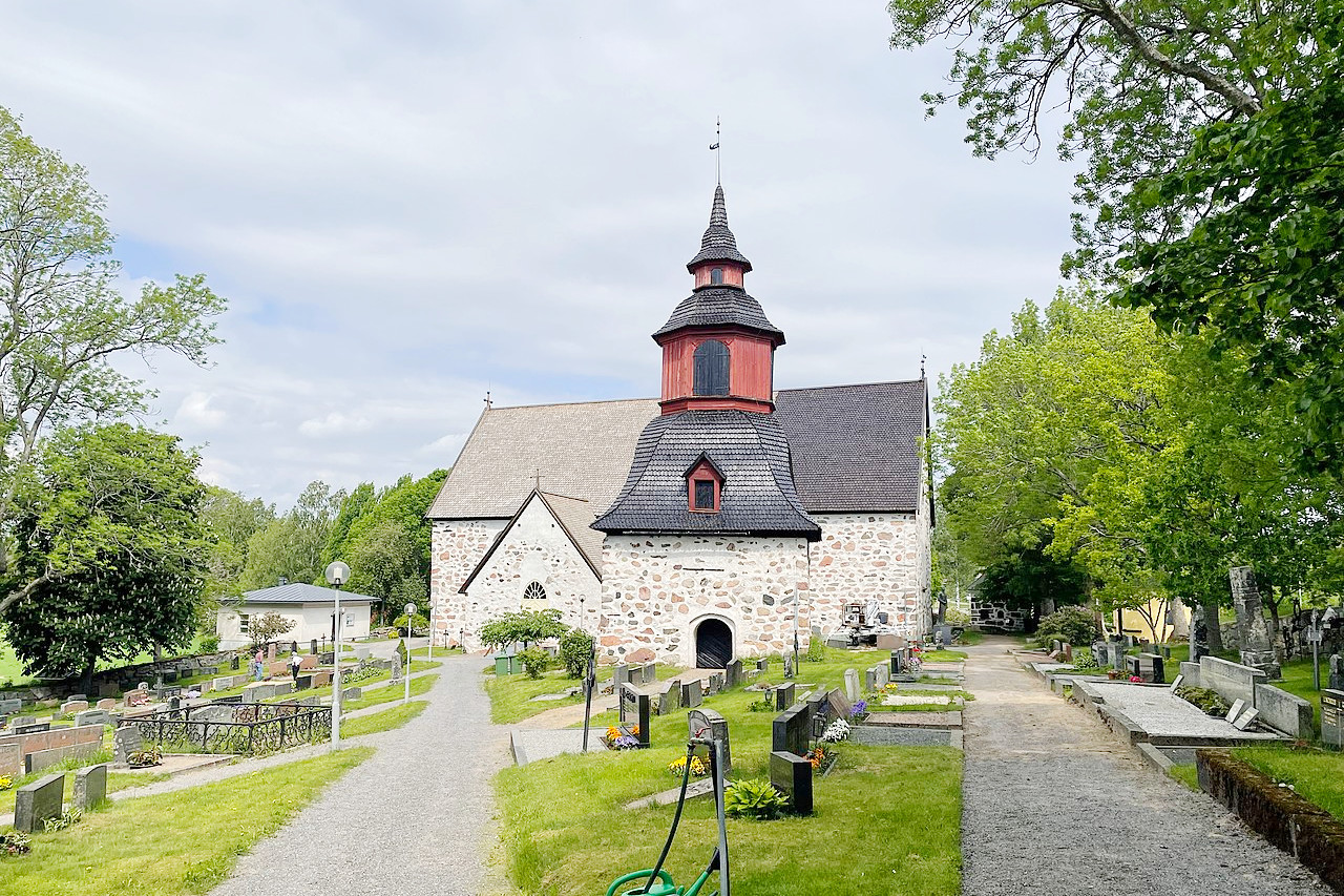 Tenala Church, Raasepori
Climate Map
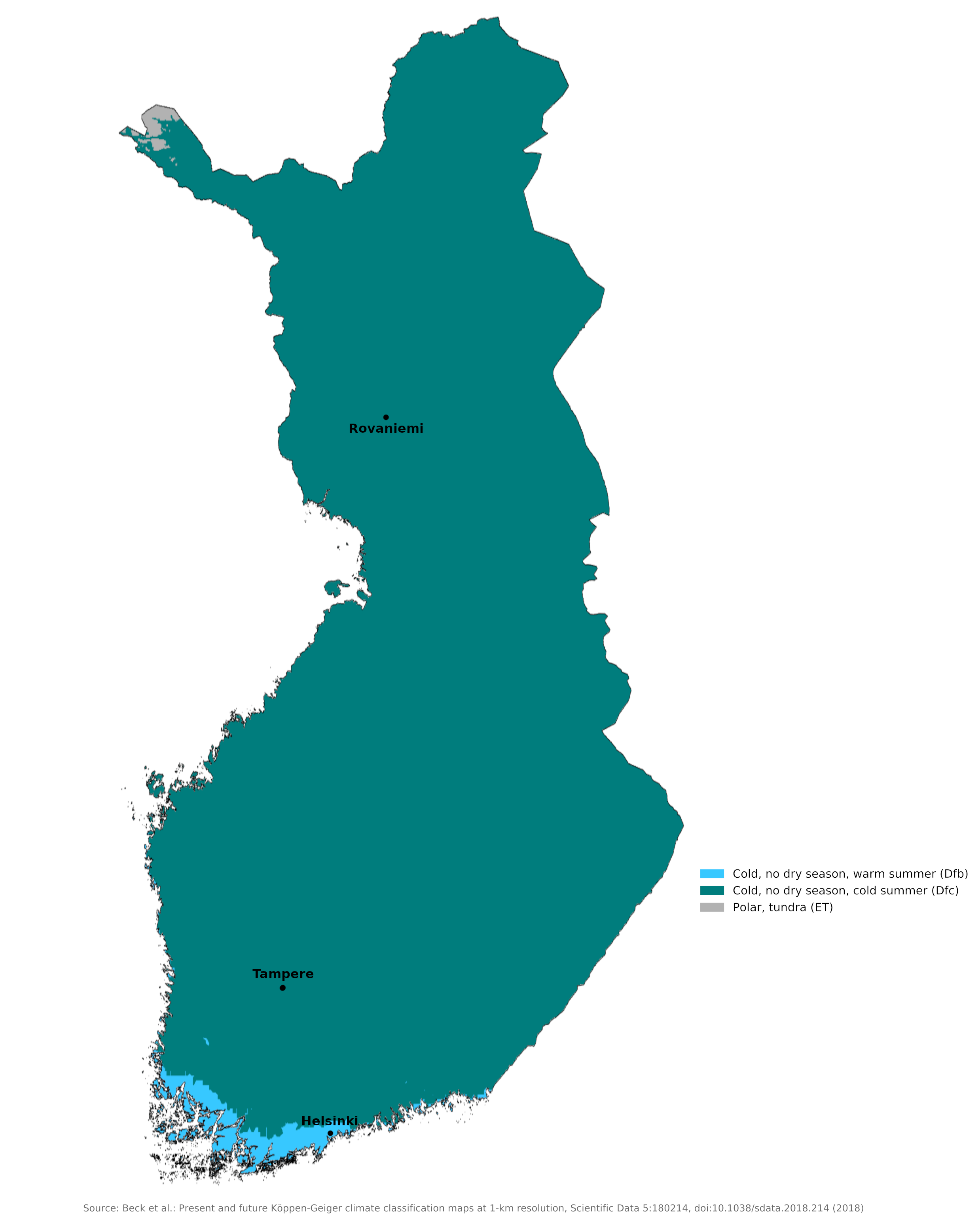 Climate map of Finland
What is the climate of Finland like?
Located in northeastern Europe, Finland is one of the northernmost countries in the world. It borders Sweden and Norway to the northwest and shares a long border with Russia to the east. About a third of Finland lies north of the Arctic Circle. The south and center of the country are low. It is a land of pine forests and countless lakes of different sizes. The north or Finnish Lapland is higher, but only along the northwestern border with Norway do hills rise over 1,000 meters (3,000 feet). There are countless small islands off the southwest coast and this is the mildest part of the country in winter as the more open waters of the Baltic Sea do not freeze over as often as the Gulf of Bothnia and the Gulf of Finland.
The warm waters of the Gulf Stream and the North Atlantic Drift Current, which warm Norway and Sweden, also warm Finland. Westerly winds bring the warm air currents into the Baltic areas and to the country's shores, moderating winter temperatures, especially in the south. Thus the climate in Finland is less severe than in the corresponding latitudes further east. However, when the continental weather from the east dominates, winters can still be severe and resemble those of Alaska or the Yukon. In contrast, the summers can be surprisingly warm, especially in the south of the country. In the north, beyond the Arctic Circle, the long hours of sunshine in midsummer partially offset the northern latitude.
In the south and center of the country, summers are as warm as in Denmark and southern Sweden (see the climate of Helsinki on the coast and Tampere inland). Summer temperatures average 18°C (65°F) in the south of the country and summer highs can reach 30°C (86°F). Winters are long and cold, with an average of 90 to 120 days of snow. The summer rain is not very heavy anywhere and in winter it is mostly snow.
| Climate data for Helsinki (1991–2020) | |||||||||||||
|---|---|---|---|---|---|---|---|---|---|---|---|---|---|
| Month | Jan | Feb | Mar | Apr | May | Jun | Jul | Aug | Sep | Oct | Nov | Dec | Year |
| Average high °C (°F) | −0.7 (30.7) | −1.3 (29.7) | 2.3 (36.1) | 8.1 (46.6) | 14.6 (58.3) | 18.8 (65.8) | 21.9 (71.4) | 20.5 (68.9) | 15.4 (59.7) | 9.2 (48.6) | 4.4 (39.9) | 1.4 (34.5) | 9.6 (49.3) |
| Daily mean °C (°F) | −3.1 (26.4) | −3.8 (25.2) | −0.7 (30.7) | 4.4 (39.9) | 10.4 (50.7) | 14.9 (58.8) | 18.1 (64.6) | 16.9 (62.4) | 12.3 (54.1) | 6.6 (43.9) | 2.4 (36.3) | −0.7 (30.7) | 6.5 (43.7) |
| Average low °C (°F) | −5.6 (21.9) | −6.3 (20.7) | −3.6 (25.5) | 1.1 (34.0) | 6.4 (43.5) | 11.2 (52.2) | 14.5 (58.1) | 13.5 (56.3) | 9.3 (48.7) | 4.2 (39.6) | 0.4 (32.7) | −2.9 (26.8) | 3.5 (38.3) |
| Average precipitation mm (inches) | 53 (2.1) | 38 (1.5) | 34 (1.3) | 34 (1.3) | 38 (1.5) | 60 (2.4) | 57 (2.2) | 81 (3.2) | 56 (2.2) | 73 (2.9) | 69 (2.7) | 58 (2.3) | 653 (25.7) |
| Average snowfall cm (inches) | 12 (4.7) | 17 (6.7) | 8 (3.1) | 0 (0) | 0 (0) | 0 (0) | 0 (0) | 0 (0) | 0 (0) | 0 (0) | 0 (0) | 1 (0.4) | 38 (15) |
| Source: Ilmatieteen Laitos | |||||||||||||
| Climate data for Tampere (1981–2010) | |||||||||||||
|---|---|---|---|---|---|---|---|---|---|---|---|---|---|
| Month | Jan | Feb | Mar | Apr | May | Jun | Jul | Aug | Sep | Oct | Nov | Dec | Year |
| Average high °C (°F) | −3.4 (25.9) | −3.5 (25.7) | 1.2 (34.2) | 8.2 (46.8) | 15.4 (59.7) | 19.5 (67.1) | 22.2 (72.0) | 19.9 (67.8) | 14.0 (57.2) | 7.5 (45.5) | 1.5 (34.7) | −1.9 (28.6) | 8.4 (47.1) |
| Daily mean °C (°F) | −6.4 (20.5) | −6.9 (19.6) | −2.8 (27.0) | 3.3 (37.9) | 9.7 (49.5) | 14.1 (57.4) | 16.9 (62.4) | 15.0 (59.0) | 9.8 (49.6) | 4.6 (40.3) | 0.6 (33.1) | −4.5 (23.9) | 4.4 (39.9) |
| Average low °C (°F) | −9.7 (14.5) | −10.6 (12.9) | −6.6 (20.1) | −1.3 (29.7) | 3.8 (38.8) | 8.6 (47.5) | 11.7 (53.1) | 10.4 (50.7) | 5.9 (42.6) | 1.9 (35.4) | −3.0 (26.6) | −7.6 (18.3) | 0.3 (32.5) |
| Average precipitation mm (inches) | 41 (1.6) | 29 (1.1) | 31 (1.2) | 32 (1.3) | 41 (1.6) | 66 (2.6) | 75 (3.0) | 72 (2.8) | 58 (2.3) | 60 (2.4) | 51 (2.0) | 42 (1.7) | 598 (23.5) |
| Average snowfall cm (inches) | 32.3 (12.7) | 31.4 (12.4) | 29.5 (11.6) | 13.9 (5.5) | 1.6 (0.6) | 0.1 (0.0) | 0 (0) | 0 (0) | 0 (0) | 3.3 (1.3) | 13.1 (5.2) | 27.2 (10.7) | 152.4 (60) |
| Source: weatheronline.co.uk | |||||||||||||
Winter is very long in the north of the country; snow cover lasts from mid-October to late April or mid-May. There are winter lows of up to 30°C below zero (22°F below zero) and permanent snow caps that rest on the northern slopes of the highest peaks. However, in the brief arctic summer, daytime temperatures can climb almost as high as in the south, and sunshine can average nine to ten hours a day (see Rovaniemi for example). A nuisance, an indirect consequence of the summer climate, is the swarms of midges and midges that appear in warm weather. These are particularly annoying in the north of the country.
However, the weather is changeable from day to day in all seasons as Finland is influenced to some extent by weather disturbances originating over the Atlantic. The longest periods of stable weather are most common in winter.
| Climate data for Rovaniemi (1981-2010) | |||||||||||||
|---|---|---|---|---|---|---|---|---|---|---|---|---|---|
| Month | Jan | Feb | Mar | Apr | May | Jun | Jul | Aug | Sep | Oct | Nov | Dec | Year |
| Record high °C (°F) | |||||||||||||
| Average high °C (°F) | −7.9 (17.8) | −7.7 (18.1) | −2.2 (28.0) | 4.0 (39.2) | 11.1 (52.0) | 17.2 (63.0) | 19.8 (67.6) | 16.2 (61.2) | 10.7 (51.3) | 3.4 (38.1) | −2.6 (27.3) | −6.0 (21.2) | 4.7 (40.4) |
| Daily mean °C (°F) | −10.9 (12.4) | −10.6 (12.9) | −5.9 (21.4) | 0.1 (32.2) | 6.4 (43.5) | 12.4 (54.3) | 15.5 (59.9) | 12.6 (54.7) | 7.3 (45.1) | 1.0 (33.8) | −5.3 (22.5) | −9.1 (15.6) | 1.1 (34.0) |
| Average low °C (°F) | −14.2 (6.4) | −13.3 (8.1) | −9.3 (15.3) | −3.6 (25.5) | 2.5 (36.5) | 8.2 (46.8) | 11.5 (52.7) | 8.9 (48.0) | 4.4 (39.9) | −0.9 (30.4) | −7.5 (18.5) | −12.2 (10.0) | −2.1 (28.2) |
| Average precipitation mm (inches) | 42.1 (1.66) | 33.6 (1.32) | 35.6 (1.40) | 30.9 (1.22) | 35.9 (1.41) | 59.1 (2.33) | 69.1 (2.72) | 71.7 (2.82) | 54.0 (2.13) | 54.6 (2.15) | 48.6 (1.91) | 41.7 (1.64) | 576.9 (22.71) |
| Average snowfall cm (inches) | 52 (20) | 70 (28) | 76 (30) | 46 (18) | 0 (0) | 0 (0) | 0 (0) | 0 (0) | 0 (0) | 1 (0.4) | 14 (5.5) | 33 (13) | 292 (115) |
| Source: Ilmatieteen Laitos | |||||||||||||
The long winter causes about half of the annual precipitation in the north to fall as snow. Precipitation in the south also occurs all through the year, though not so much of it is snow. The average annual precipitation (including rain and snow) ranges from 430 millimeters (17 inches) in northern Finland to 710 millimeters (28 inches) in southern Finland. Snow cover lasts from around 90 days in the Åland Islands to 250 days in the extreme northwest.
Northern Finland is famous for its "midnight sun". For about seventy days from mid-May, the sun never sets and is visible even at night. Even the southern part of the country can get up to nineteen hours of sunshine on summer days. Another climate-related phenomenon in the north is Kaamos, the polar night, when even the brightest day is dark and spectacular Northern Lights can often be seen in the sky.
When is the best time to visit Finland?
Summer is warm, and July is the warmest month. The fall comes suddenly, in early September; in southern Finland the snow starts in December; in the north it is falling in October.
The duration of the "midnight sun" varies. At Rovaniemi, just a few miles below the Arctic Circle, it is light enough to read at night from 6 June–5 July; at Utsjoki, from 18 May–25 July. The duration of the “polar night” varies also, starting above the Arctic Circle and increasing until its maximum duration at Utsjoki, 26 Nov–16 Jan.
References
- E. A. Pearce, Charles Gordon Smith, (1990) The Hutchinson World Weather Guide, John Murray Press. ISBN 1859863426
- Timothy L. Gall, (ed.), (2003), Worldmark Encyclopedia of the Nations, Eleventh Edition, Thomson Gale
- Federal Research Division, Library of Congress, (1990), Finland: a country study. Claitor's Pub. Division.
- Hugh Chisholm, (ed.), (1911), Encyclopædia Britannica, Eleventh edition, Cambridge University Press
The Climate of
Finland
In summary:
Because of the warming influence of the Gulf Stream and the prevailing wind patterns, Finland’s climate is comparatively mild for the high latitude. Temperatures are coldest in the north, however, with winter lows down to 30°C below zero (22°F below zero). But summer temperatures for the country as a whole average about 13°C to 18°C (55°F to 65°F).
Average annual precipitation (a mix of both snow and rain) varies from about 430 mm (17 in) in the north to 710 mm (28 in) in the south.