The Climate of
Papua New Guinea
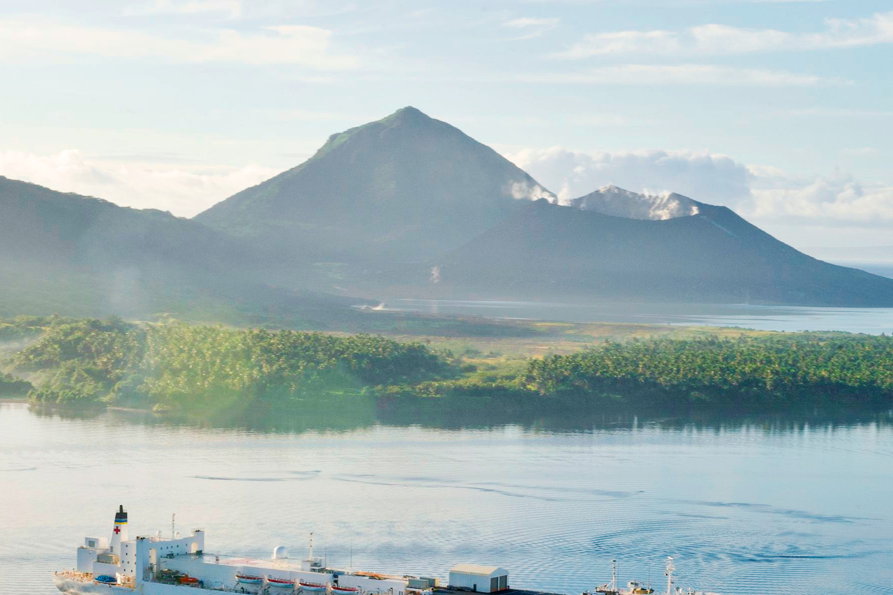 Simpson Harbor off the coast of Rabaul
Climate Map
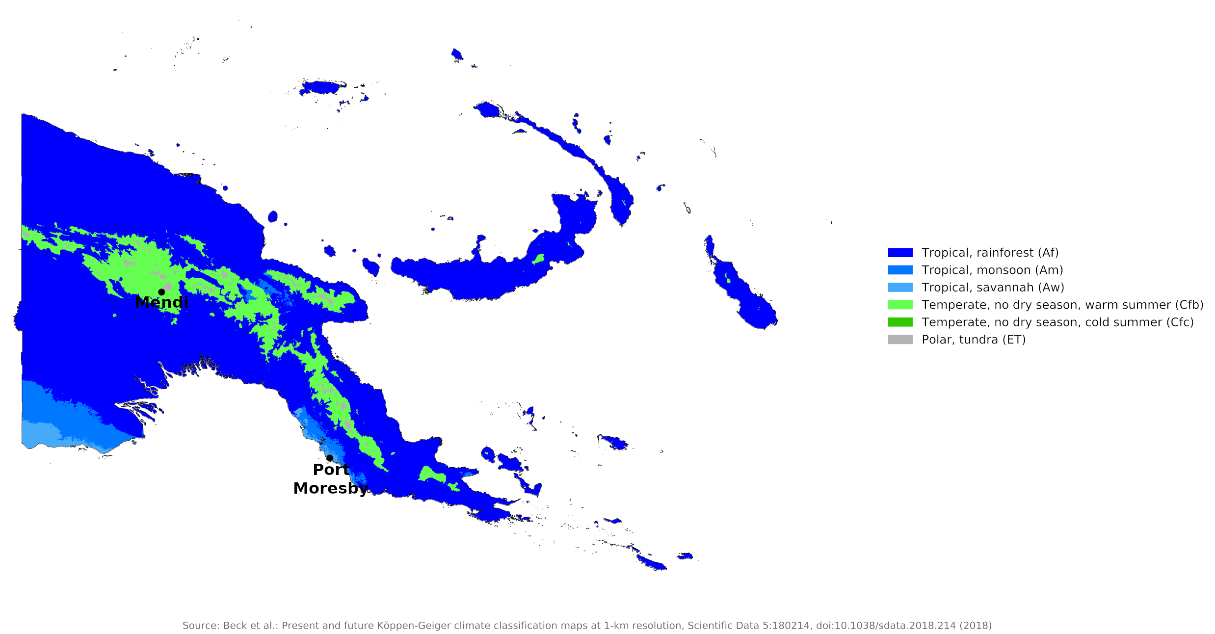 Climate map of Papua New Guinea
What is the climate of Papua New Guinea like?
Papua New Guinea includes the eastern half of the island of New Guinea and a group of offshore islands, all located in the southwest Pacific between the Coral Sea and the South Pacific Ocean. The country shares a land border with Indonesia. The island of New Guinea is three times the size of the United Kingdom and lies to the north of Australia between the equator and 12°S. The western half of the island is the Indonesian province of Irian Jaya and the eastern half is the Commonwealth state of Papua New Guinea. The island of New Guinea has a single range of high mountains running from east to west. There is an extensive swampy lowland in the south.
The weather and climate of Papua New Guinea are tropical. The climate is chiefly influenced by altitude and by the alternating north and south monsoons: the northwest or wet monsoon prevails from December to March, and the southeast or dry trade winds from May to October. Temperatures at near sea-level are high throughout the year, with little variation from month to month. Average lowland temperatures range from 21°C to 32°C (70°F to 90°F). The weather and climate of the neighbouring islands of New Britain, New Ireland, and the small islands of the Bismarck Archipelago are similar to that of the main island of New Guinea. The New Guinea highlands though experience a cooler subtropical highland climate with cool mornings, warm afternoons and heavy rainfall throughout the year.
Papua New Guinea has a typical monsoonal climate. Its rainfall patterns are influenced by two principle seasonal pressure systems, the northwest or wet monsoon (December to March) originating in Asia and the southeast monsoon or dry trade winds (May to October). This monsoon pattern is the southern extension of the larger Asian-Australian monsoon system that moves seasonally from the northern hemisphere into the tropical regions of the south during December to February. It is characterised by reversal of prevailing winds that are responsible for causing movement from very dry to very wet conditions. It affects countries in the far western Pacific and the Indonesian archipelago.
In Papua New Guinea these monsoons are affected by the mountain ranges, and divide the year into two definite wind seasons. The northwest monsoon season prevails from December to March, with the winds blowing from either the west or northwest. The southeast monsoon season occurs from May to October, and at that time the trade winds blow inland from a southeast or easterly direction. Both of these winds pass over large expanses of ocean before reaching the islands and are heavily laden with moisture. This results in heavy rainfall.
The average annual rainfall for all of Papua New Guinea is 2,000 to 2,500 millimeters (80 to 100 inches). The climate of Port Moresby, on the south coast, is representative of the temperature and humidity around the year at low levels. Port Moresby, however is located in a rain shadow, and with an annual rainfall of 900 millimeters (35 inches), is one of the driest places. The heaviest rainfall occurs on the coasts and mountain ranges exposed to the southeast trade winds. New Guinea's western river basin region averages up to 5,800 millimeters (230 inches) a year. The climate of Mendi is representative of the Highlands provinces.
| Climate data for Port Moresby | |||||||||||||
|---|---|---|---|---|---|---|---|---|---|---|---|---|---|
| Month | Jan | Feb | Mar | Apr | May | Jun | Jul | Aug | Sep | Oct | Nov | Dec | Year |
| Average high °C (°F) | 32.1 (89.8) | 31.6 (88.9) | 31.4 (88.5) | 31.3 (88.3) | 31.0 (87.8) | 30.3 (86.5) | 29.9 (85.8) | 30.3 (86.5) | 31.0 (87.8) | 32.0 (89.6) | 32.5 (90.5) | 32.4 (90.3) | 31.3 (88.3) |
| Daily mean °C (°F) | 27.4 (81.3) | 27.3 (81.1) | 27.1 (80.8) | 27.0 (80.6) | 26.9 (80.4) | 26.1 (79.0) | 25.7 (78.3) | 26.1 (79.0) | 26.5 (79.7) | 27.5 (81.5) | 27.6 (81.7) | 27.8 (82.0) | 26.9 (80.4) |
| Average low °C (°F) | 23.7 (74.7) | 23.5 (74.3) | 23.4 (74.1) | 23.5 (74.3) | 23.5 (74.3) | 23.1 (73.6) | 22.4 (72.3) | 22.6 (72.7) | 23.2 (73.8) | 23.5 (74.3) | 23.6 (74.5) | 23.7 (74.7) | 23.3 (73.9) |
| Average precipitation mm (inches) | 192.2 (7.57) | 140.6 (5.54) | 189.8 (7.47) | 105.2 (4.14) | 56.2 (2.21) | 21.6 (0.85) | 13.8 (0.54) | 12.0 (0.47) | 14.4 (0.57) | 15.2 (0.60) | 40.0 (1.57) | 97.8 (3.85) | 898.8 (35.38) |
| Source: World Meteorological Organization | |||||||||||||
| Climate data for Mendi | |||||||||||||
|---|---|---|---|---|---|---|---|---|---|---|---|---|---|
| Month | Jan | Feb | Mar | Apr | May | Jun | Jul | Aug | Sep | Oct | Nov | Dec | Year |
| Average high °C (°F) | 23.8 (74.8) | 23.6 (74.5) | 23.4 (74.1) | 23.6 (74.5) | 23.6 (74.5) | 22.6 (72.7) | 21.9 (71.4) | 22.3 (72.1) | 22.7 (72.9) | 23.3 (73.9) | 23.7 (74.7) | 23.7 (74.7) | 23.2 (73.7) |
| Daily mean °C (°F) | 18.3 (64.9) | 18.3 (64.9) | 18.2 (64.8) | 18.2 (64.8) | 18.2 (64.8) | 17.1 (62.8) | 16.8 (62.2) | 17.2 (63.0) | 17.5 (63.5) | 17.6 (63.7) | 17.8 (64.0) | 18.2 (64.8) | 17.8 (64.0) |
| Average low °C (°F) | 12.8 (55.0) | 13.1 (55.6) | 13.1 (55.6) | 12.8 (55.0) | 12.8 (55.0) | 11.7 (53.1) | 11.8 (53.2) | 12.1 (53.8) | 12.4 (54.3) | 12 (54) | 11.9 (53.4) | 12.7 (54.9) | 12.4 (54.4) |
| Average precipitation mm (inches) | 239 (9.4) | 261 (10.3) | 286 (11.3) | 246 (9.7) | 209 (8.2) | 192 (7.6) | 211 (8.3) | 244 (9.6) | 263 (10.4) | 270 (10.6) | 221 (8.7) | 252 (9.9) | 2,894 (114) |
| Source: Climate-Data.org | |||||||||||||
Much of Papua New Guinea gets its rain from the northwest monsoon from December through March, but some areas, such as the Trobriand Islands, get their main rainfall from May through October. The Louisiade Archipelago in the southeast lies out of the monsoon pattern, so rainfall occurs there year-round.
Much of the rain comes in heavy downpours, accompanied by thunder, during afternoon and evening storms; but longer periods of rain occur during the wettest months. The weather in the lowlands is sultry and humid but at higher levels the lower temperature makes for much more pleasant conditions.
References
- E. A. Pearce, Charles Gordon Smith, (1990) The Hutchinson World Weather Guide, John Murray Press. ISBN 1859863426
- Timothy L. Gall, (ed.), (2003), Worldmark Encyclopedia of the Nations, Eleventh Edition, Thomson Gale
- Margaret Egudo and Paul Bennett, (2014), Pre-Deployment Handbook Papua New Guinea. Joint and Operations Analysis Divisions.
- Hugh Chisholm, (ed.), (1911), Encyclopædia Britannica, Eleventh edition, Cambridge University Press
The Climate of
Papua New Guinea
In summary:
Papua New Guinea is a tropical country, but it has two main seasons: the northwest or wet monsoon prevails from December to March, and the southeast or dry trade winds from May to October. Most of the lowland and island areas have daily mean temperatures of about 27°C (81°F) while highland areas are much cooler.
Annual rainfall varies widely with the monsoon pattern, ranging from as little as 1250 mm (50 in) at Port Moresby to an average of 5800 mm (230 in) in the western river basin.