The Climate of
Iraq
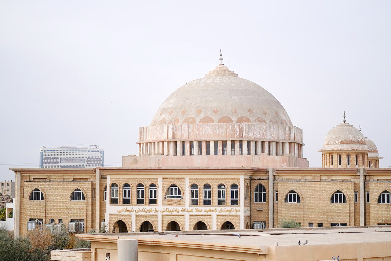 Mosque in the city of Erbil, the Kurdistan Region
Climate Map
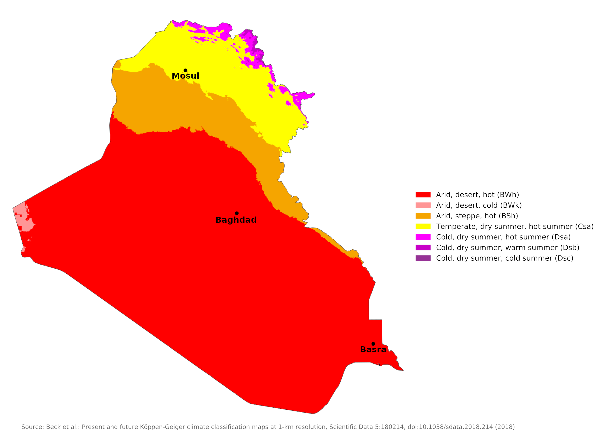 Climate map of Iraq
What is the climate of Iraq like?
Iraq is a nearly landlocked country sandwiched between Turkey on the north, Iran on the east, Saudi Arabia and Kuwait on the south, and Jordan and Syria on the west. It has a very short coastline on the Gulf. Most of the country is flat and low-lying, consisting of the low plateau of the Syrian and Arabian deserts to the west, and the broad valleys of the Tigris and Euphrates rivers (ancient Mesopotamia) in central Iraq. These rivers join the Gulf in a common channel, the Shatt-al-Arab, near Basra. Northeast Iraq (Kurdistan) is mountainous and the climate is similar to that of the mountains of western Iran.
Iraq has a very harsh climate with a clear contrast between extremely hot, sunny and dry summers and a cooler winter with some rain. Intensely hot and dry summers last from May to October, and during the hottest part of the day people take refuge in underground shelters. Temperatures can to go over 46°C (115°F) during the hottest part of the day.
Winters, which last from December to March, are wet and comparatively cold, with temperatures averaging around 10°C (50°F). Temperatures sometimes fall below freezing. Spring and fall are short transition periods. There is usually no rain from the end of May to the end of September.
The summer months are marked by two kinds of wind. The southerly and southeasterly sharqi, a dry, dusty wind with occasional gusts, occurs from April to early June and again from late September through November. It may last for only a day at the beginning and at the end of the season but for several days at other times. This wind is often accompanied by violent duststorms. From mid-June to mid-September, the prevailing wind, called the shamal, is from the north and northwest. It is a steady wind, absent only occasionally during this period. The very dry air brought by this shamal accompanies intensive heating of the land surface by the sun, but the breeze has some cooling effect.
Iraq has some of the highest temperatures in the world. Heatstroke and even heatstroke are dangers. There is not much difference in summer temperatures from north to south, but temperatures are significantly lower and more comfortable in the mountains of Kurdistan at this time. Winters are very mild in the south but get cooler towards the north. There is occasional frost and snow in the north, and heavy snowfall can occur in Kurdistan.
Most of the country has a desert or steppe climate with annual rainfall of less than 200 millimeters (8 inches). Heavier precipitation falls only in the northern plains around Mosul and Kirkuk and in the mountains of Kurdistan. The summer months from May to September are practically rain-free and the heaviest rain falls between December and March. Spring snowmelt in the mountains of Turkey, Iran and Kurdistan causes flooding of the Tigris and Euphrates rivers between March and May, a time when Iraq's long, hot, dry summer begins.
The combination of rain shortage and extreme heat makes much of Iraq a desert. Because of very high rates of evaporation, soil and plants rapidly lose the little moisture obtained from the rain, and vegetation could not survive without extensive irrigation. Some mountain areas, however, although arid, do have natural vegetation in contrast to the desert. Oak trees are found in the mountains in the northeast, and date palms are found in the south.
Baghdad is representative of year-round conditions in most of the Iraqi lowlands. Basra shows the south, where the summer heat is even more oppressive. Conditions in the northern plains are represented by Mosul.
| Climate data for Baghdad | |||||||||||||
|---|---|---|---|---|---|---|---|---|---|---|---|---|---|
| Month | Jan | Feb | Mar | Apr | May | Jun | Jul | Aug | Sep | Oct | Nov | Dec | Year |
| Average high °C (°F) | 15.5 (59.9) | 18.5 (65.3) | 23.6 (74.5) | 29.9 (85.8) | 36.5 (97.7) | 41.3 (106.3) | 44.0 (111.2) | 43.5 (110.3) | 40.2 (104.4) | 33.4 (92.1) | 23.7 (74.7) | 17.2 (63.0) | 30.6 (87.1) |
| Daily mean °C (°F) | 9.7 (49.5) | 12 (54) | 16.6 (61.9) | 22.6 (72.7) | 28.3 (82.9) | 32.3 (90.1) | 34.8 (94.6) | 34 (93) | 30.5 (86.9) | 24.7 (76.5) | 16.5 (61.7) | 11.2 (52.2) | 22.8 (73.0) |
| Average low °C (°F) | 3.8 (38.8) | 5.5 (41.9) | 9.6 (49.3) | 15.2 (59.4) | 20.1 (68.2) | 23.3 (73.9) | 25.5 (77.9) | 24.5 (76.1) | 20.7 (69.3) | 15.9 (60.6) | 9.2 (48.6) | 5.1 (41.2) | 14.9 (58.8) |
| Average precipitation mm (inches) | 26 (1.0) | 28 (1.1) | 28 (1.1) | 17 (0.7) | 7 (0.3) | 0 (0) | 0 (0) | 0 (0) | 0 (0) | 3 (0.1) | 21 (0.8) | 26 (1.0) | 156 (6.1) |
| Source: World Meteorological Organization | |||||||||||||
| Climate data for Basra | |||||||||||||
|---|---|---|---|---|---|---|---|---|---|---|---|---|---|
| Month | Jan | Feb | Mar | Apr | May | Jun | Jul | Aug | Sep | Oct | Nov | Dec | Year |
| Average high °C (°F) | 18.4 (65.1) | 21.7 (71.1) | 27.7 (81.9) | 33.9 (93.0) | 40.7 (105.3) | 45.3 (113.5) | 46.9 (116.4) | 47.1 (116.8) | 43.2 (109.8) | 36.8 (98.2) | 25.9 (78.6) | 19.8 (67.6) | 33.9 (93.1) |
| Daily mean °C (°F) | 12.9 (55.2) | 15.7 (60.3) | 21.0 (69.8) | 27.2 (81.0) | 33.9 (93.0) | 38.3 (100.9) | 40.0 (104.0) | 39.8 (103.6) | 35.7 (96.3) | 29.6 (85.3) | 20.1 (68.2) | 14.4 (57.9) | 27.4 (81.3) |
| Average low °C (°F) | 7.6 (45.7) | 9.5 (49.1) | 13.9 (57.0) | 19.7 (67.5) | 25.9 (78.6) | 30.4 (86.7) | 32.3 (90.1) | 31.9 (89.4) | 27.8 (82.0) | 22.4 (72.3) | 14.5 (58.1) | 9.2 (48.6) | 20.4 (68.8) |
| Average precipitation mm (inches) | 34 (1.3) | 19 (0.7) | 23 (0.9) | 11 (0.4) | 4 (0.2) | 0 (0) | 0 (0) | 0 (0) | 0 (0) | 7 (0.3) | 30 (1.2) | 31 (1.2) | 159 (6.2) |
| Source: Climate-Data.org | |||||||||||||
| Climate data for Mosul | |||||||||||||
|---|---|---|---|---|---|---|---|---|---|---|---|---|---|
| Month | Jan | Feb | Mar | Apr | May | Jun | Jul | Aug | Sep | Oct | Nov | Dec | Year |
| Average high °C (°F) | 12.4 (54.3) | 14.8 (58.6) | 19.3 (66.7) | 25.2 (77.4) | 32.7 (90.9) | 39.2 (102.6) | 42.9 (109.2) | 42.6 (108.7) | 38.2 (100.8) | 30.6 (87.1) | 21.1 (70.0) | 14.1 (57.4) | 27.8 (82.0) |
| Daily mean °C (°F) | 7.3 (45.1) | 9.1 (48.4) | 13.1 (55.6) | 18.2 (64.8) | 24.5 (76.1) | 30.3 (86.5) | 34.0 (93.2) | 33.4 (92.1) | 28.7 (83.7) | 22.1 (71.8) | 14.2 (57.6) | 9.0 (48.2) | 20.3 (68.6) |
| Average low °C (°F) | 2.2 (36.0) | 3.4 (38.1) | 6.8 (44.2) | 11.2 (52.2) | 16.2 (61.2) | 21.3 (70.3) | 25.0 (77.0) | 24.2 (75.6) | 19.1 (66.4) | 13.5 (56.3) | 7.2 (45.0) | 3.8 (38.8) | 12.8 (55.1) |
| Average precipitation mm (inches) | 62.1 (2.44) | 62.7 (2.47) | 63.2 (2.49) | 44.1 (1.74) | 15.2 (0.60) | 1.1 (0.04) | 0.2 (0.01) | 0.0 (0.0) | 0.3 (0.01) | 11.8 (0.46) | 45.0 (1.77) | 57.9 (2.28) | 363.6 (14.31) |
| Source: World Meteorological Organization | |||||||||||||
References
- E. A. Pearce, Charles Gordon Smith, (1990) The Hutchinson World Weather Guide, John Murray Press. ISBN 1859863426
- Timothy L. Gall, (ed.), (2003), Worldmark Encyclopedia of the Nations, Eleventh Edition, Thomson Gale
- Federal Research Division, Library of Congress, (1990), Iraq: a country study. Claitor's Pub. Division.
- Hugh Chisholm, (ed.), (1911), Encyclopædia Britannica, Eleventh edition, Cambridge University Press
The Climate of
Iraq
In summary:
Iraq has intensely hot and dry summers last from May to October; winters, lasting from December to March, are damp and comparatively cold. Spring and autumn are brief transition periods. Normally, no rain falls from the end of May to the end of September.
Mean annual rainfall is between 100 and 170 mm (4 and 7 in). Rainfall is higher in the northern mountains.